Precise Surveying with Drones
Surveying drones offer significant advantages across numerous industries – from automated area mapping and the creation of accurate 3D models to high-resolution 2D aerial imagery.
By combining georeferenced data with high-precision camera systems, models can be generated with millimeter-level accuracy.
This makes surveying tasks faster, safer, and more cost-efficient compared to traditional methods.
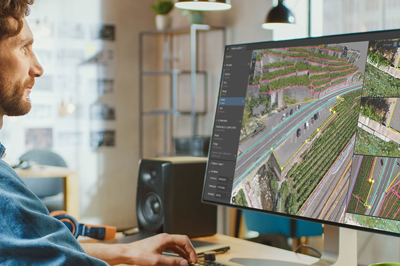
Surveying drones can autonomously follow predefined flight routes, capturing high-resolution images at regular intervals. Combined with georeferenced data, this produces accurate 3D point clouds of areas, structures, or objects. These datasets form the basis for volume calculations, digital surface models, and many other geodetic applications – performed quickly, efficiently, and with exceptional accuracy.
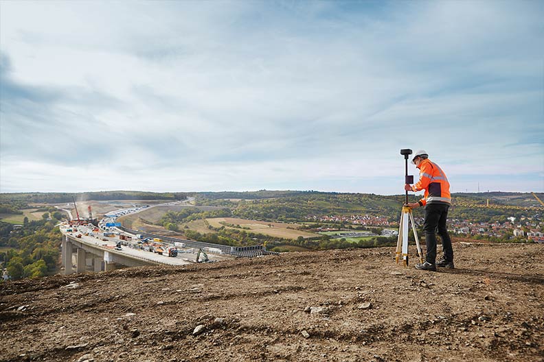
Current orthophotos are indispensable for many property owners and architects – for example, when planning or documenting construction projects. With a surveying drone, the required aerial images can be captured within minutes and at the touch of a button. The resulting data is current, high-resolution, and far more detailed than satellite imagery – making it ideal for precise and efficient project planning directly from the desk.
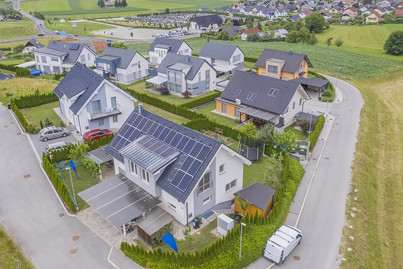
With a professional drone, you can capture high-quality aerial images that make any property listing stand out. Drone photography provides unique perspectives, showcasing a property’s architecture, location, and surroundings in an impressive way. This gives your real estate presentation a modern and professional appeal, creating a strong first impression for potential buyers.
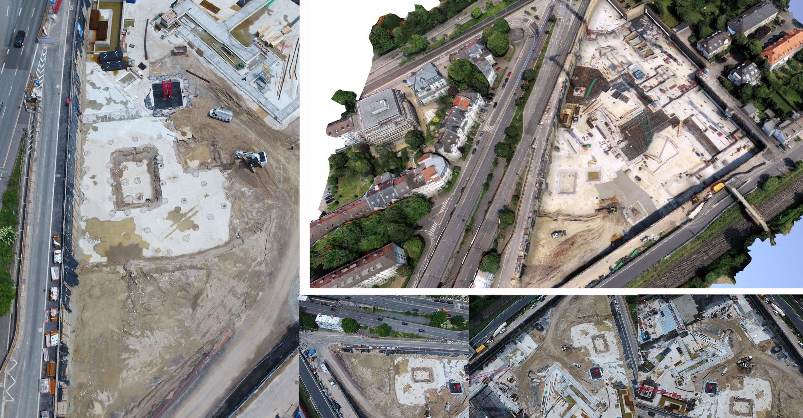
With a drone, you always have a clear overview of construction sites and properties – efficiently, safely, and with precision. The high-resolution aerial images provide both a comprehensive overall view and detailed visuals of individual construction phases. This enables seamless construction site documentation, ideal for a digital construction log and project progress monitoring.
Current orthophotos are indispensable for many property owners and architects – for example, when planning or documenting construction projects. With a surveying drone, the required aerial images can be captured within minutes and at the touch of a button. The resulting data is current, high-resolution, and far more detailed than satellite imagery – making it ideal for precise and efficient project planning directly from the desk.
Surveying drones can autonomously follow predefined flight routes, capturing high-resolution images at regular intervals. Combined with georeferenced data, this produces accurate 3D point clouds of areas, structures, or objects. These datasets form the basis for volume calculations, digital surface models, and many other geodetic applications – performed quickly, efficiently, and with exceptional accuracy.
With a drone, you always have a clear overview of construction sites and properties – efficiently, safely, and with precision. The high-resolution aerial images provide both a comprehensive overall view and detailed visuals of individual construction phases. This enables seamless construction site documentation, ideal for a digital construction log and project progress monitoring.
With a professional drone, you can capture high-quality aerial images that make any property listing stand out. Drone photography provides unique perspectives, showcasing a property’s architecture, location, and surroundings in an impressive way. This gives your real estate presentation a modern and professional appeal, creating a strong first impression for potential buyers.
>> Solectric Industrial Drone Solutions: Phone +49 7251 9369390, E-Mail industrial@solectric.de <<