LiDAR sensors at Solectric
LiDAR is an advanced radar method for optical distance measurement. While conventional radar systems use radio waves, LiDAR works with a laser/light beam. The emitted light pulse is reflected by the striking object, detected by a receiver unit and evaluated. The more precisely the received signal is determined and processed, the smaller objects can be detected.
The speed of light constant is used as the basis for calculating the distance. Important for this is the resulting time from exit of the signal to the reception of the reflected signal. If this time is halved, the distance to the object can be determined. This system has many applications in autonomous vehicles and is also suitable for integration on drone systems. In the end, the data obtained can be used to create high-resolution maps for a wide variety of fields. For example, for surveying, geology, forestry and many more.
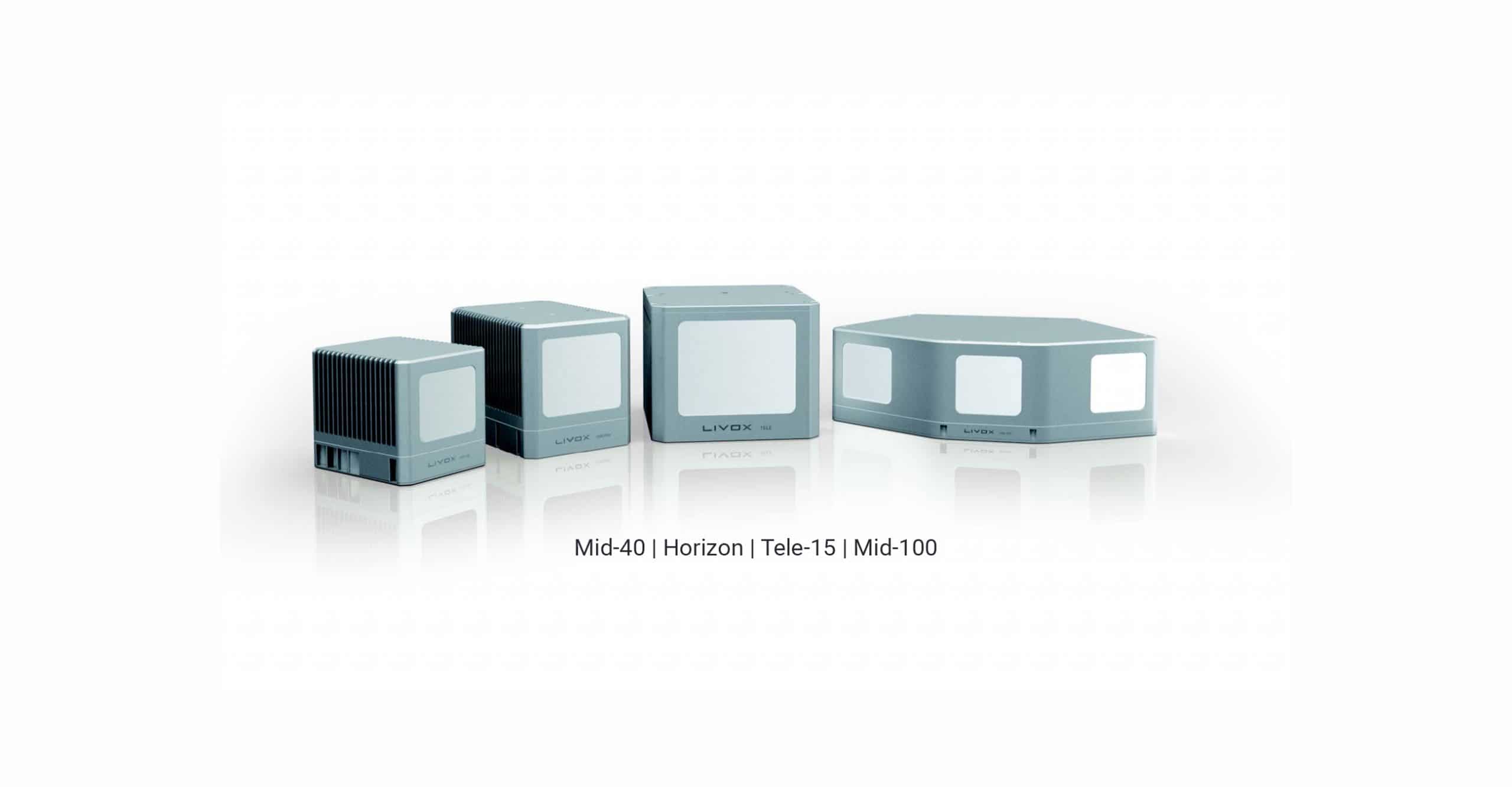
Livox has launched three breakthrough LiDAR products: the Mid-Series, the Horizon, and the Tele-15.
The Mid-Series is the industrial-grade LiDAR sensor that offers great value and is open to customization.
The Livox Horizon is a high performance LiDAR sensor designed for autonomous driving level 3 and 4. The Horizon is ready to make mass production of autonomous vehicles a reality.
The Tele-15 is a low-cost automotive LiDAR with a range of 500 meters and an extremely dense point cloud.
With the Livox Hub, all installed Livox LiDAR can be combined with each other. The Hub supports precise time synchronization, accesses up to 9 LiDAR sensors and integrates all LiDAR point data into a single output.
With flexible combinations of the above products, Livox LiDAR units can fulfill different scenarios in a cost-effective and innovative way.
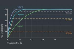
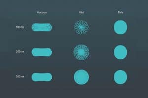
Livox LIDAR sensors feature non-repetitive scanning patterns that differ significantly from the repetitive linear scanning of conventional mechanical LIDAR sensors. The scanned areas within the field of view (FOV) of a Livox sensor become larger the longer the integration time, increasing the likelihood of detecting objects and other details within the FOV. As shown here, a Livox LIDAR unit can scan nearly the entire area within the FOV as integration time increases. The Livox Tele-15 even achieves 99.8% FOV coverage within 100 ms, outperforming 128-line mechanical LIDAR sensors.
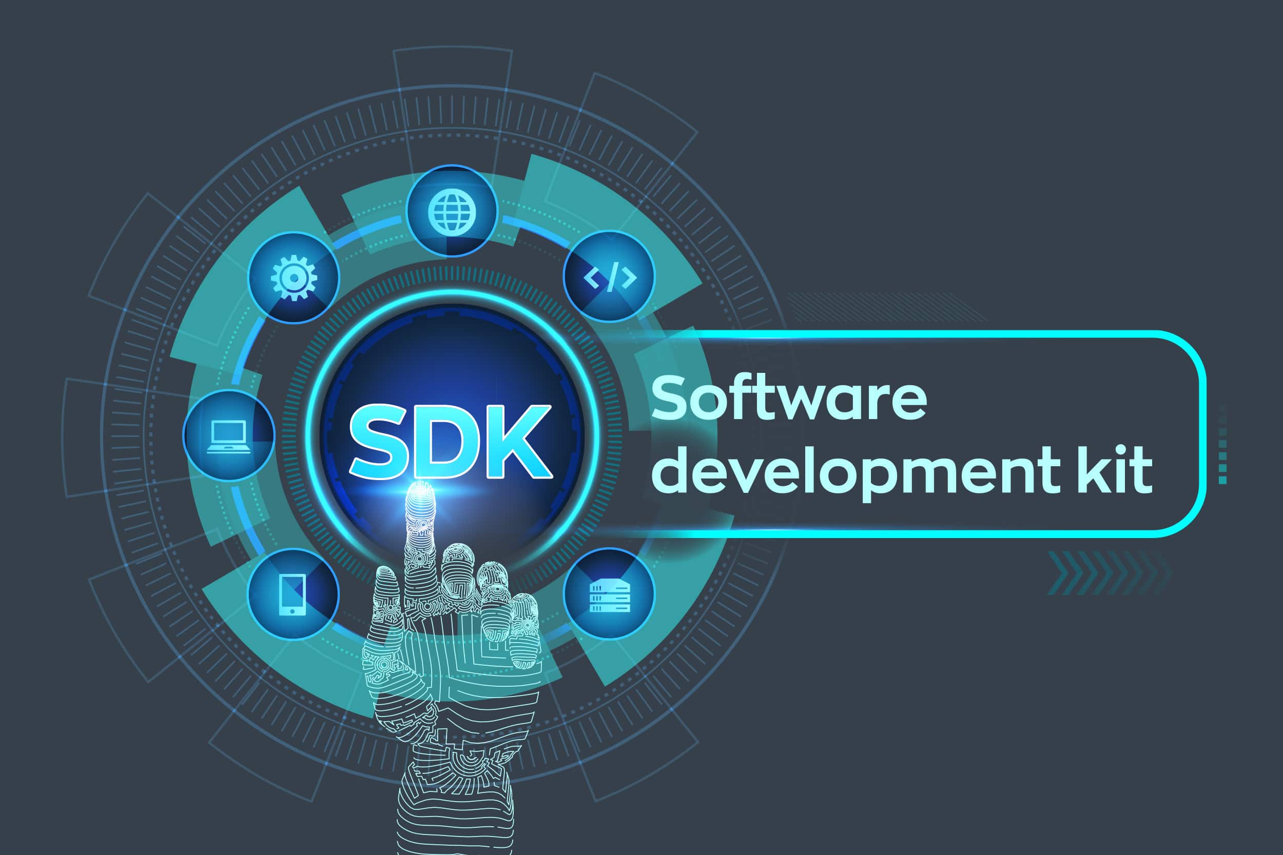
To unleash the unlimited potential of LIDAR, Livox SDK provides a wide range of essential tools that help users develop unique applications and algorithms. Livox SDK supports development languages such as C, C++, and Python on various platforms including Linux, Windows, and ROS.
Livox also offers commonly used open source algorithms such as SLAM and external parameter calibration to help users get the best results from their LIDAR sensors.
Labeled data is also offered, which includes commonly encountered objects such as vehicles, pedestrians, and bicycles. Users are helped to quickly verify algorithms and increase efficiency.
Application scenarios
RoboTaxis
Horizon – 360 degree cover with 5 pieces, easy to integrate.
Tele-15 – versatile and cost-effective, coverage up to 500 meters.
Mobile Robotics
Mid-100 – wide FOV, high density point cloud, and obstacle detection in complex environments.
Mid-40 – detects obstacles at close range and effectively supports mapping, navigation and obstacle avoidance.
3D surveying
.
Mid-40 – cost-effective performance, nearly 100% point cloud coverage in 1 sec.
Airborne mapping
Mid- 40 – compact and lightweight, thus compatible with various flight platforms, easy installation.
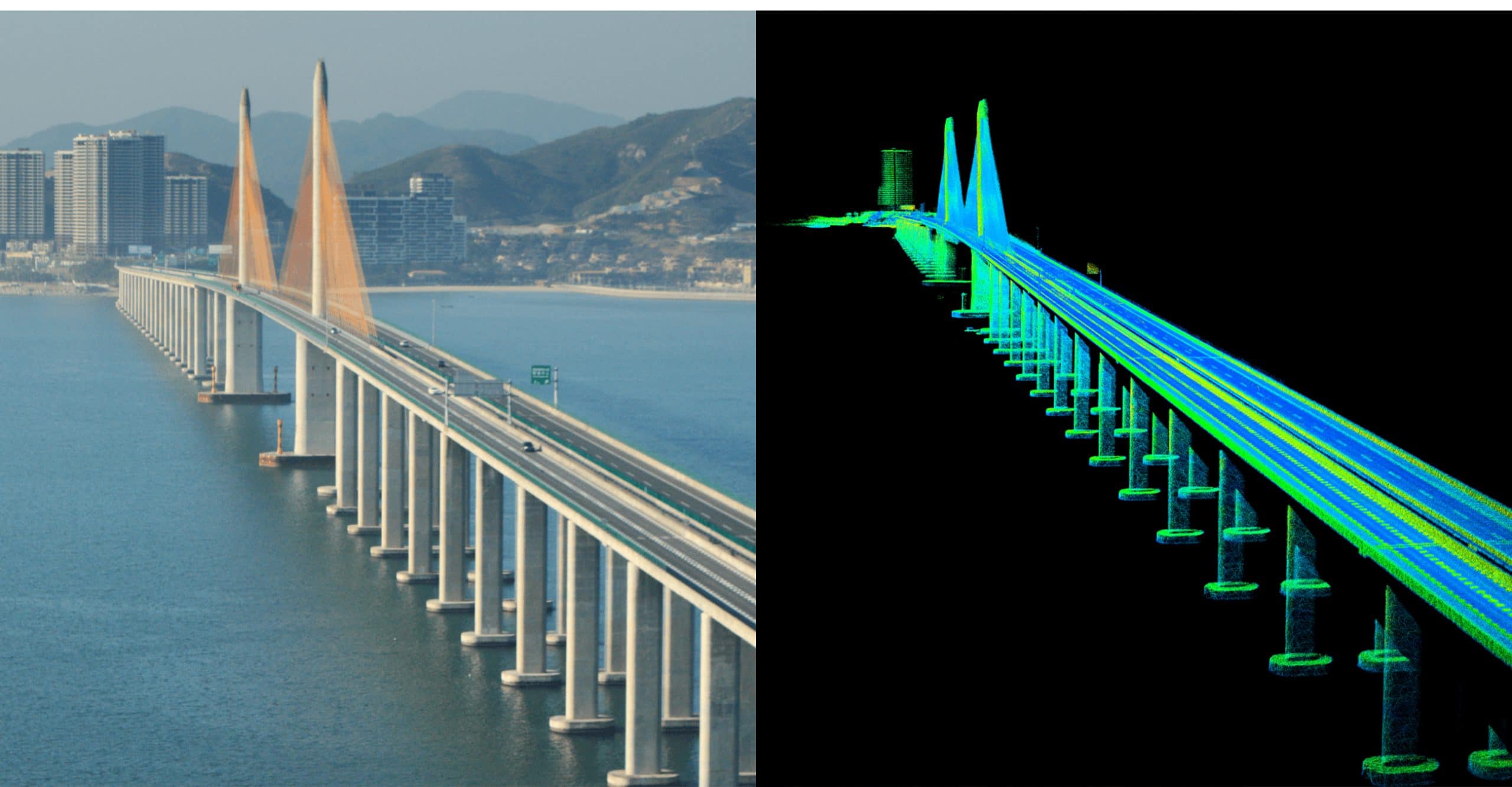
To illustrate the enormous potential of 3D mapping using Livon LiDAR sensors in conjunction with a drone system, Livox mapped the three-kilometer “Huizhou Bay Bridge” in the southern Chinese province of Guangdong, near Hong Kong. For the example, a Livox Mid-40 was used in conjunction with a DJI M600. Due to the small dimensions of the Mid-40, the setup could also be attached to a smaller drone, such as the DJI M200 series.
To illustrate the enormous potential of 3D mapping using Livon LiDAR sensors in conjunction with a drone system, Livox mapped the three-kilometer “Huizhou Bay Bridge” in the southern Chinese province of Guangdong, near Hong Kong. For the example, a Livox Mid-40 was used in conjunction with a DJI M600. Due to the small dimensions of the Mid-40, the setup could also be attached to a smaller drone, such as the DJI M200 series.
>> Contact Solectric Industrial Solutions: Phone +49 7251 9369390, E-Mail industrial@solectric.de <<