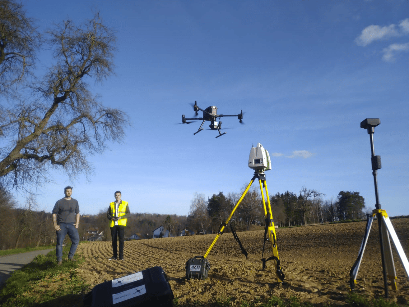
The Institute for Water and Watercourse Development (KIT/IWG) is working on the topic of heavy rainfall modeling within the framework of a research project commissioned by the State of BW*. This project is concerned with the hydraulic runoff processes on natural surfaces, in particular the so-called thin-film runoff with very shallow flow depths, which has a significant influence on the runoff pattern and thus the risk to localities. With a corresponding scientific background, natural surfaces (fields, meadows) are to be measured at high resolution. This should allow later conclusions of the seasonally changing roughness structures on the runoff process and thus contribute to a general improvement of the heavy rain risk management (e.g. simulation models). A farmland near Karlsruhe provides the ideal boundary conditions for the investigations. In addition to terrestrial laser scans, we surveyed and mapped the farmland using the DJI Zenmuse L1 and the DJI Zenmuse P1. The data were reconstructed with the DJI Terra and transferred to the KIT/IWG. In this context, especially against the background of increasingly finer resolution simulation models, the comparison of data density/quality, recording time, etc. of the different measurement methodologies is of course very interesting for us.
* The research project is running at the Landesanstalt für Umwelt Baden-Württemberg (LUBW) under the acronym WiPaD “Untersuchungen zur Widerstandsparametrisierung von natürlichen Oberflächen bei Dünnfilmabfluss”.
Click here to learn more about surveying.